The earliest inhabitants of the land in the vicinity of the Seventh Street Bridge were the Yokuts. During the Spanish mission period, Spanish colonial settlers enslaved Indigenous peoples, including the Yokuts, to work as laborers on the missions, displacing them from their villages, languages, and culture. The Yokuts population was decimated by violence and disease that increased after the discovery of gold in 1848 and the influx of European and American settlers. Although a number of treaties were promised, they were never ratified and the remaining Yokuts and their descendants were forced to live on reservations including the Santa Rosa Rancheria and Tule River Reservation.
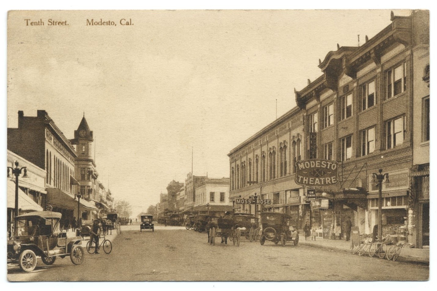
Present-day Modesto was established in 1870 when the Central Pacific Railroad Company (later Southern Pacific) completed their route through Modesto. Central Pacific purchased the land and plotted the town that would be Modesto with a new railroad depot at its center. The railroad attracted many new residents and agriculture boosted the local economy. Modesto grew quickly, becoming the Stanislaus County seat and a hub for commerce and culture in the region. When irrigation systems were completed in the early twentieth century, dry-farming of wheat gave way to vineyards, orchards, and dairy farming. Stanislaus County would become one of the leading dairy producers in California, which contributed to its continued commercial, residential, and civic growth. Dairy was such an important part of life in Modesto that the opening ceremony for the Seventh Street Bridge involved smashing a bottle of milk over the side, instead of the more traditional wine or champagne.
The Tuolumne River is about 150 miles long. It flows west from the Sierra Nevada mountains through Yosemite National Park and converges with the San Joaquin River just west of Modesto. Historically, the Tuolumne River would swell each spring as snowpack from the mountains melted, sometimes causing flooding in the Central Valley. The completion of the Seventh Street Bridge was even delayed by such a flood, when the contractor’s tools and equipment were swept away in early 1917.
Over time, dams and reservoirs were engineered and constructed to divert the river for agriculture, irrigation, drinking water, and hydroelectric power. Today, the amount of water downstream of these dams is greatly reduced, as water is stored and released from the reservoirs as needed.
Dams and Reservoirs on the Tuolumne
While many people in the region rely on the water provided by these projects, some were the subject of great controversy, particularly the Hetch Hetchy Reservoir: the debate over its construction weighed the need for a steady water supply and leaving wilderness untouched.
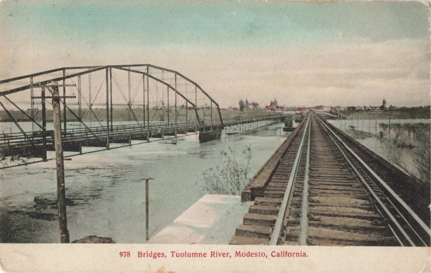
Modesto’s famous “Lion Bridge” was the third bridge (not counting railroad bridges) to cross the Tuolumne River in this location. Before there was a bridge here, people crossed by ferry. In 1884, the City of Modesto was incorporated and a “turntable bridge” was constructed over the Tuolumne River to replace the ferry. A few years later in 1887, the turntable bridge was replaced by a trestle bridge constructed by the Pacific Bridge Company. The trestle bridge ran parallel to the railroad tracks to the east.
By 1915, a new highway route traveled along Seventh Street and the trestle bridge could no longer handle the amount of traffic crossing the river, especially as cars and trucks replaced horses and wagons. Designs for a sturdy new bridge began as early as 1916.
In 1909, the California state legislature passed the State Highways Act, which established the state highway system and allotted money for its construction. It took effect after voter approval in 1910. The Golden State Highway, also known as Highway 99, was a main north-south corridor through California. When it first opened in 1915, it followed existing main roads through cities, including Modesto. Highway 99 entered the north end of Modesto at Ninth Street, turned west at I Street, and exited at the south end of the city along Seventh Street.
The Seventh Street Bridge served as part of Highway 99 from 1917, the year it was completed, until 1933, the year the route was realigned to the east across the Ninth Street Bridge. Both bridges were bypassed with the completion of present-day State Route 99 in the 1960s. The Ninth Street Bridge was replaced in 2004.
Unfortunately, heavy use of the Seventh Street Bridge combined with its unique engineering caused it to deteriorate sooner than expected. Weight and speed limits were first put in place in the 1930s and further reduced in the 1960s and 1970s to try and slow the deterioration. However, even with ongoing repair and maintenance, the bridge was in extremely poor condition. In more recent years, the bridge was given very low sufficiency ratings, meaning it had become almost entirely inadequate for its current use. Despite its condition, the “Lion Bridge” was a beloved Modesto landmark.
During the late 19th and early 20th century in the United States, there was a broad push for social and political reform in response to rapid industrialization, urbanization, and corruption. This time period came to be known as the Progressive Era. Through numerous campaigns, including the Good Roads and City Beautiful movements, progressives advocated for better living and working conditions, safety regulations, and environmental conservation.
During the Progressive Era, most roads in rural areas were simply unpaved gravel or dirt which often made travel by bicycle—and later by automobile—slow, muddy, and difficult. The Good Roads movement advocated for increased funding to improve local roads for bicycles and cars. In meetings and promotional materials, this spending was framed as an investment for economic growth, better quality of life, and the overall benefits to society if access to schools and places of worship was expanded.
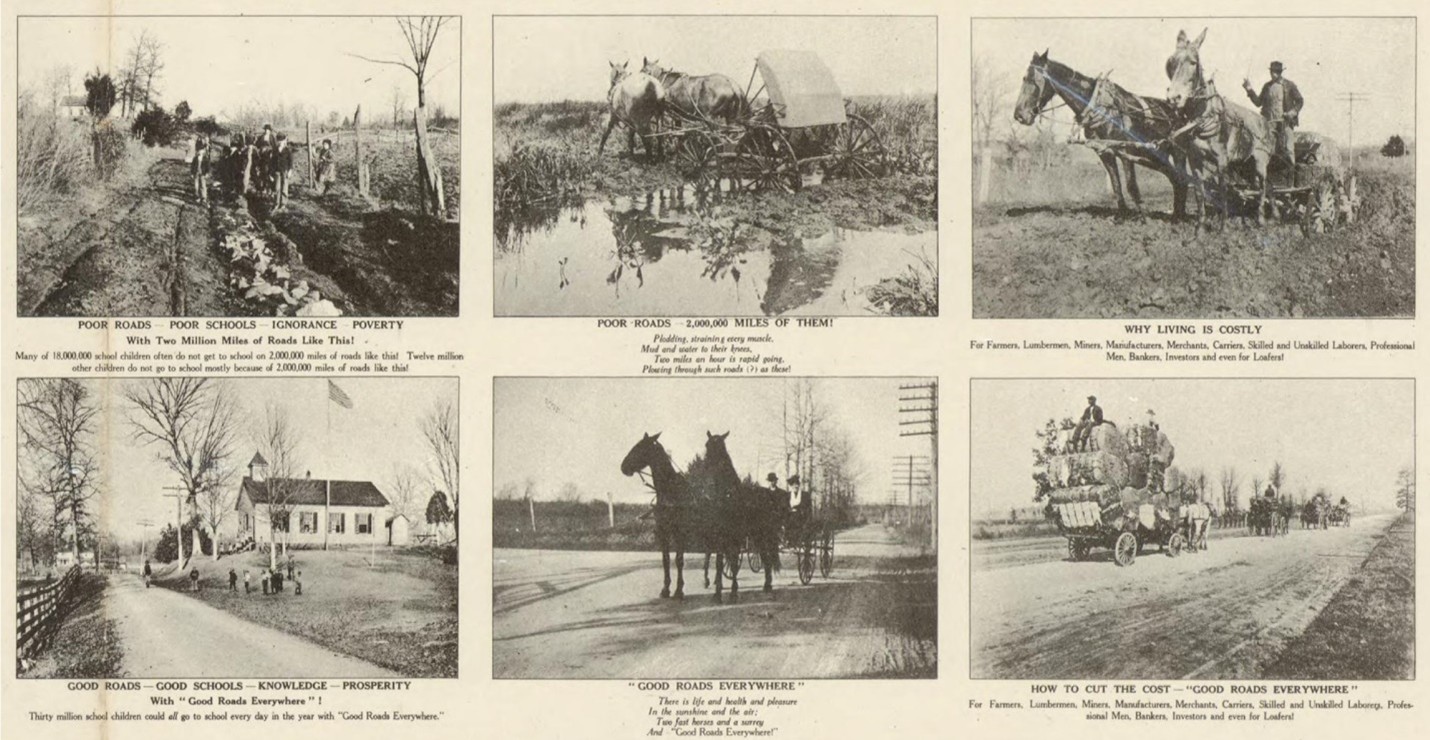
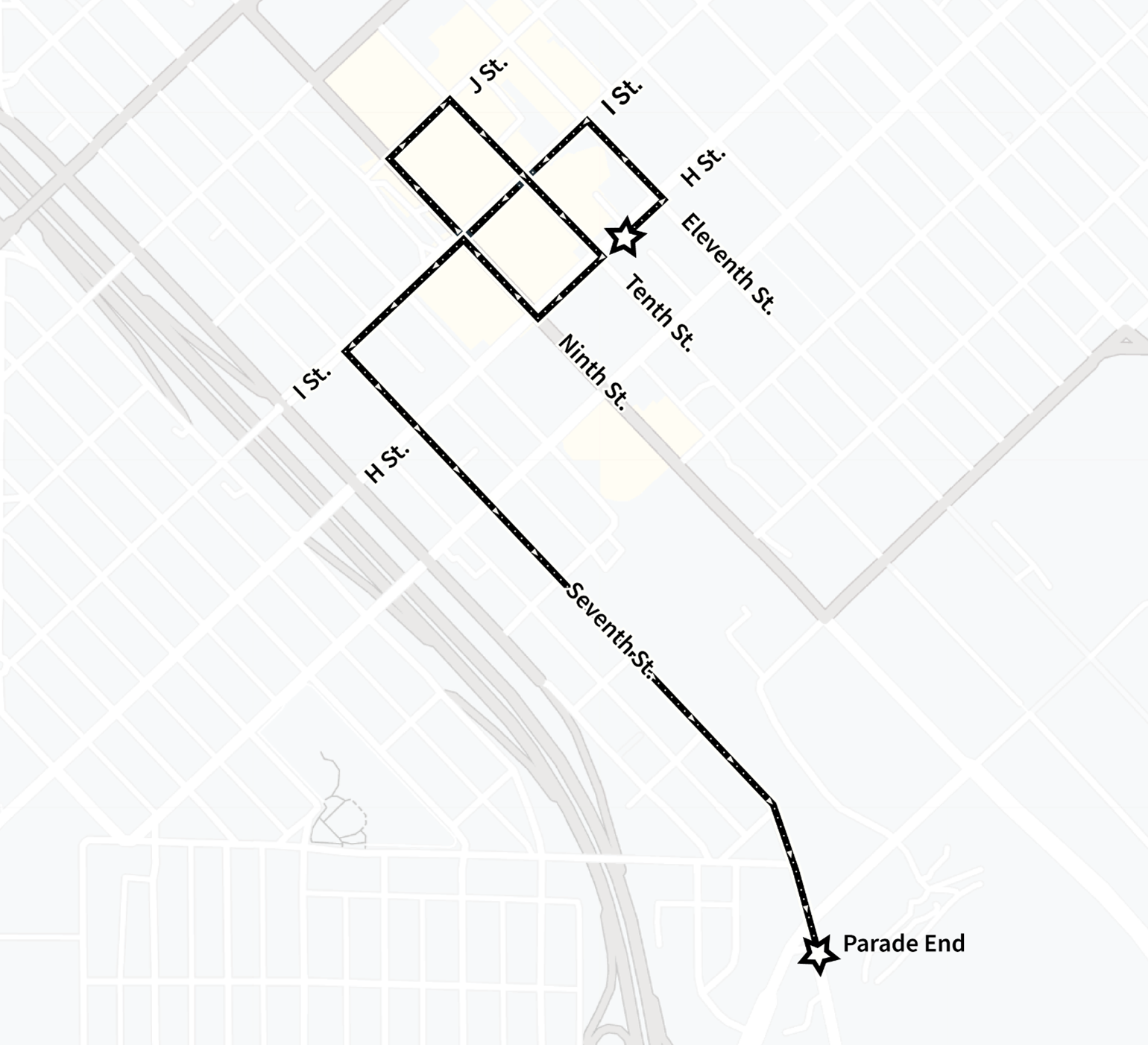
In Stanislaus County, the Good Roads movement helped usher in a nearly $1.5 million bond measure to fund road improvements—equivalent to about $40 million in 2023. The first major project completed with the bond money was the Seventh Street Bridge, which was celebrated with an automobile parade and opening ceremony on March 22, 1917. One half of the parade started in Modesto at 10th and H Streets, the other half started in Ceres, and they met in the middle at the new bridge.
Cities were quickly expanding and industrializing at the turn of the 20th century, which could cause crowded, dirty, and chaotic conditions. In response to these rapid changes, the City Beautiful Movement emerged. Popularized by the 1893 World’s Columbian Exposition in Chicago, the movement promoted the idea that beautiful, orderly cities would be more successful and desirable places to live. The movement called for careful city planning, civic improvements, and building beautiful public parks, museums, and gardens for all to enjoy.
In the early 20th century, Modesto was a thriving community. Civic and social groups like the Women’s Improvement Club contributed to improving the quality of life in Modesto by helping to establish parks and libraries, planting trees, and organizing activities such as donation drives, cleanups, and concerts.
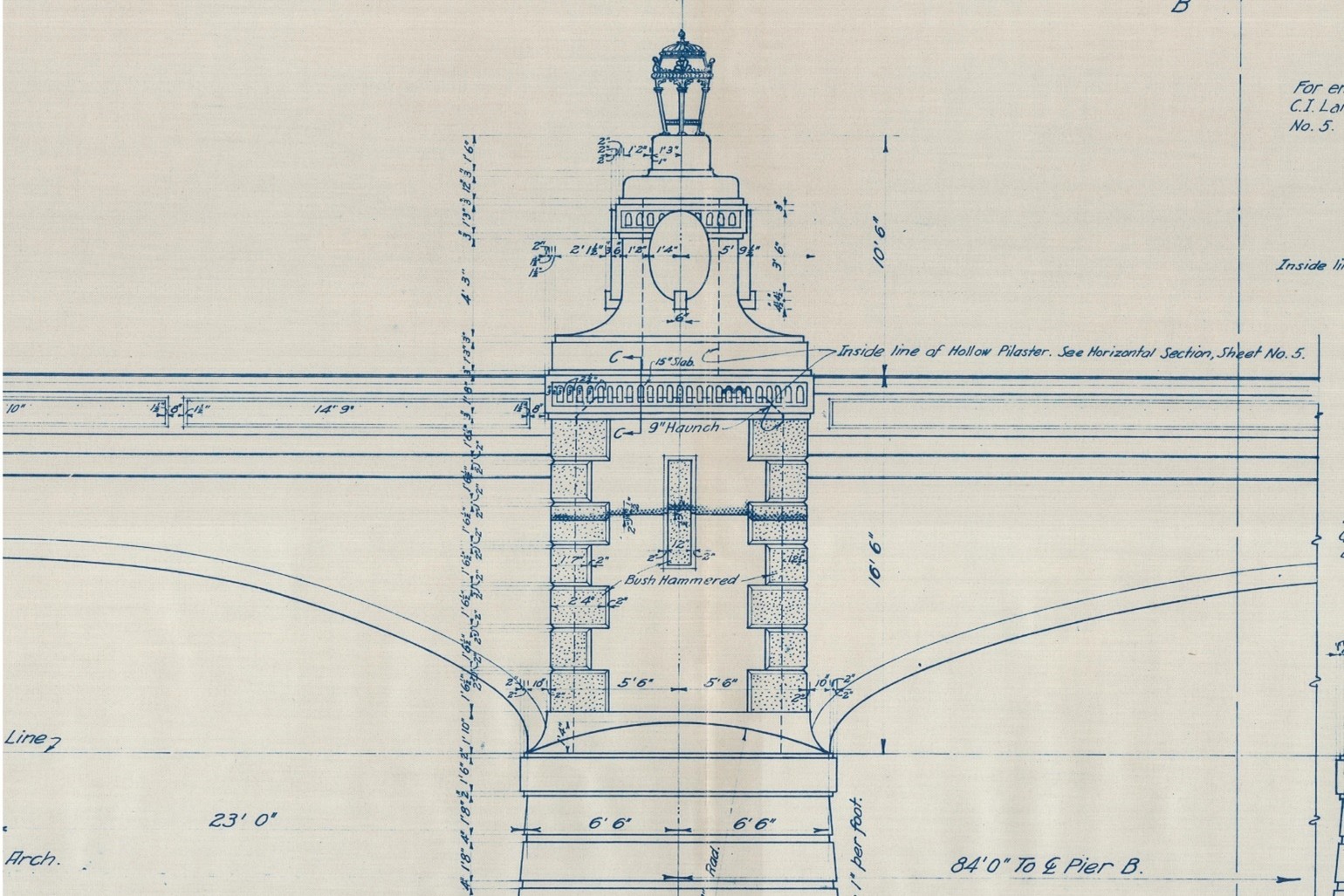
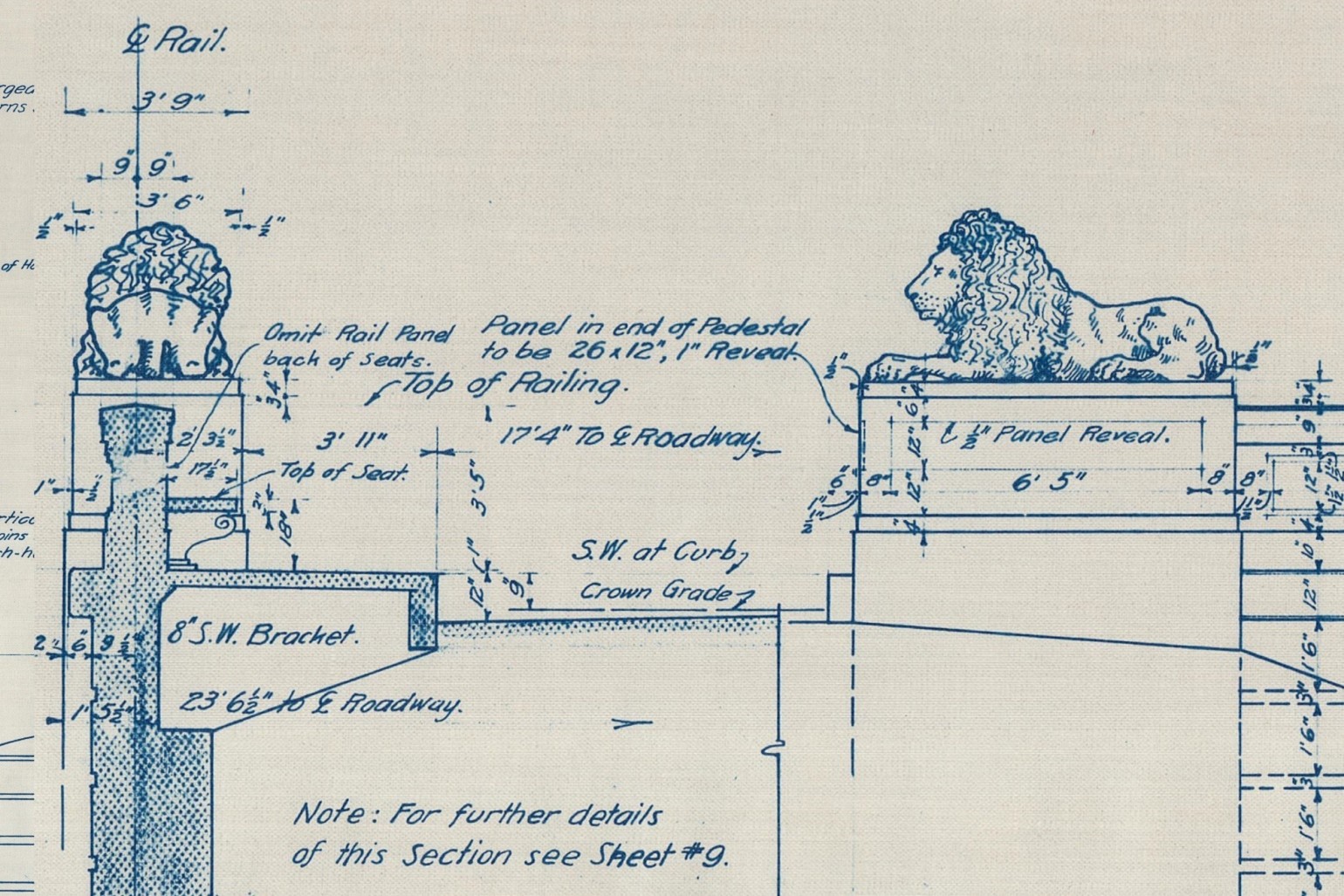
It was during this era that the Seventh Street Bridge was designed and constructed. As part of the main road into Modesto from the south, it was important for the bridge to be a beautiful and monumental gateway to the city. Its design included ornate decorative features inspired by Beaux Arts architecture such as lanterns, pylons, benches, medallions, and the four famous cast stone lions.
Beaux Arts architecture, or Beaux Arts Classicism, originated with the architectural teachings of the École des Beaux Arts in Paris. Americans began attending the school in the 1840s, and the architecture profession in the United States was soon dominated by those trained at the École. The style incorporates features from Greek, Roman, Renaissance and Baroque architecture and is characterized by its monumental appearance, elaborate ornamentation, and use of high-quality materials. Like the City Beautiful movement, Beaux Arts architecture became extremely popular after the 1893 World’s Columbian Exposition.
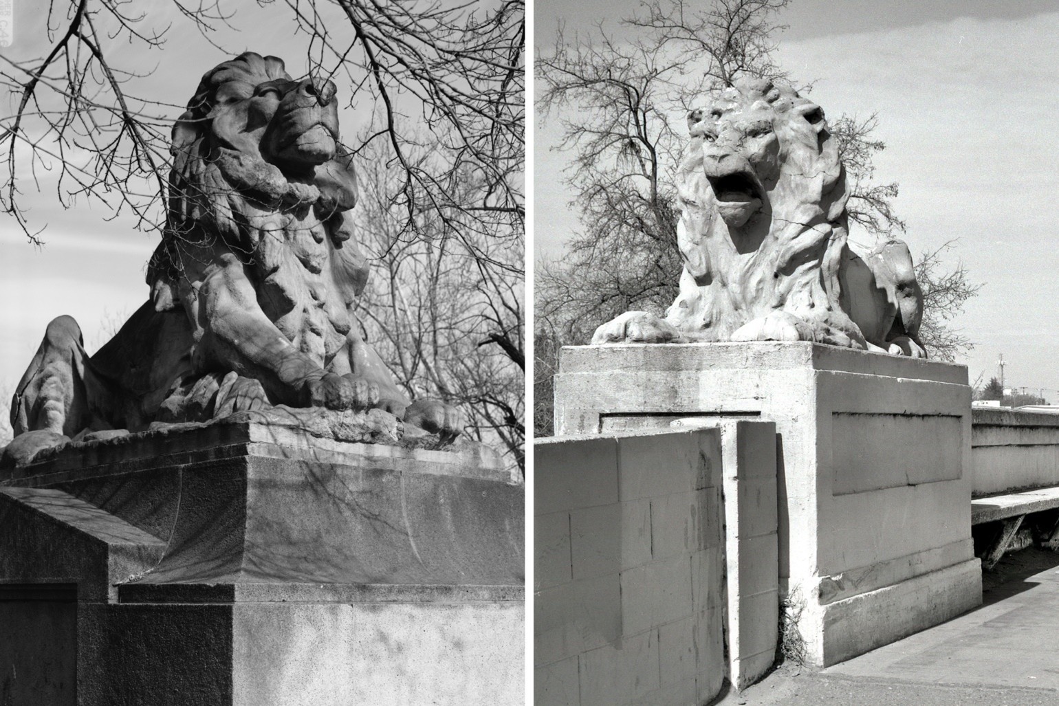
Throughout history, lions have been a prominent motif in the art and architecture of cultures around the world. They symbolize a range of meanings including royalty, strength, and courage, and have long “guarded” entrances to buildings, cities, and tombs. Taking inspiration from Greek, Roman, and Italian Renaissance architecture, the incorporation of lions into Beaux Arts designs may have been based on examples like the Lion Gate of Mycenae in Greece or the lion sculptures in the garden of the Villa Medici in Rome.
In the United States, the State of New York building and Palace of Fine Arts at the 1893 World’s Columbian Exposition featured pairs of lions sculpted by Edward Potter and A. Phimister Proctor, respectively. One year later, in 1894, two lions sculpted by Edward Kemeys were unveiled outside the nearby Art Institute of Chicago. Some of the most well-known architectural lions are the two located outside the New York Public Library building, nicknamed Patience and Fortitude. They were also sculpted by Edward Potter and installed in 1911.
In 1907, just a few years before the Seventh Street Bridge was built, the Connecticut Avenue Bridge (also known as the Taft Memorial Bridge) in Washington DC was completed. Its Beaux Arts design featured monumental cast stone lions sculpted by Roland Hinton Perry. One was placed at each corner, just like the Seventh Street Bridge. The Connecticut Avenue Bridge was considered an engineering marvel at the time of its construction and is said to have been influential in 20th century bridge design.
Italian sculptor Orestes S. Sarsi created the casts for the four Seventh Street Bridge lions in his San Francisco studio, and made the finishing touches to the faces and manes on site.
While concrete has been used in construction for thousands of years, the first use of reinforced concrete was not until the 1840s. First developed in Europe, reinforced concrete combines the qualities of concrete and steel to create a versatile building material.
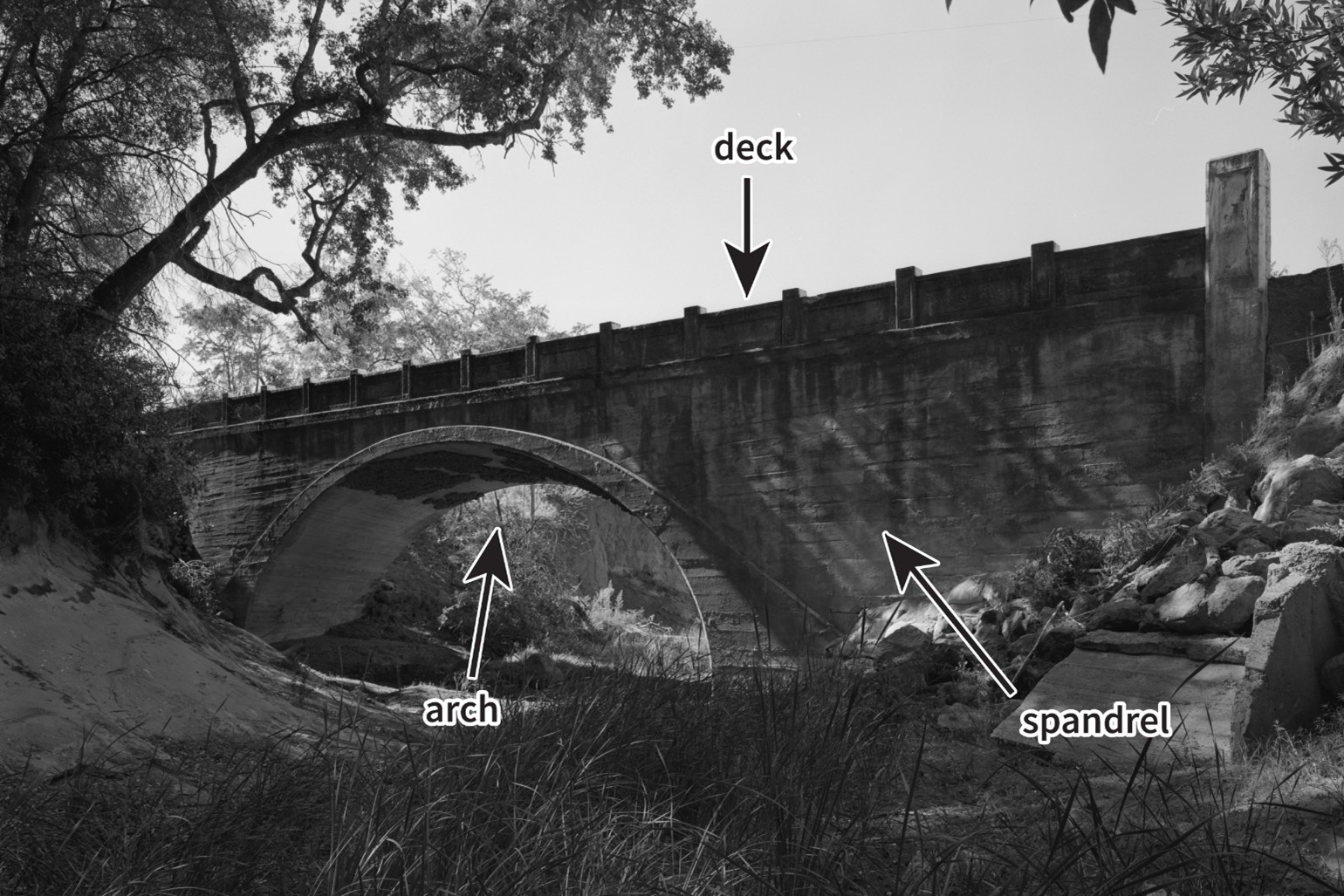
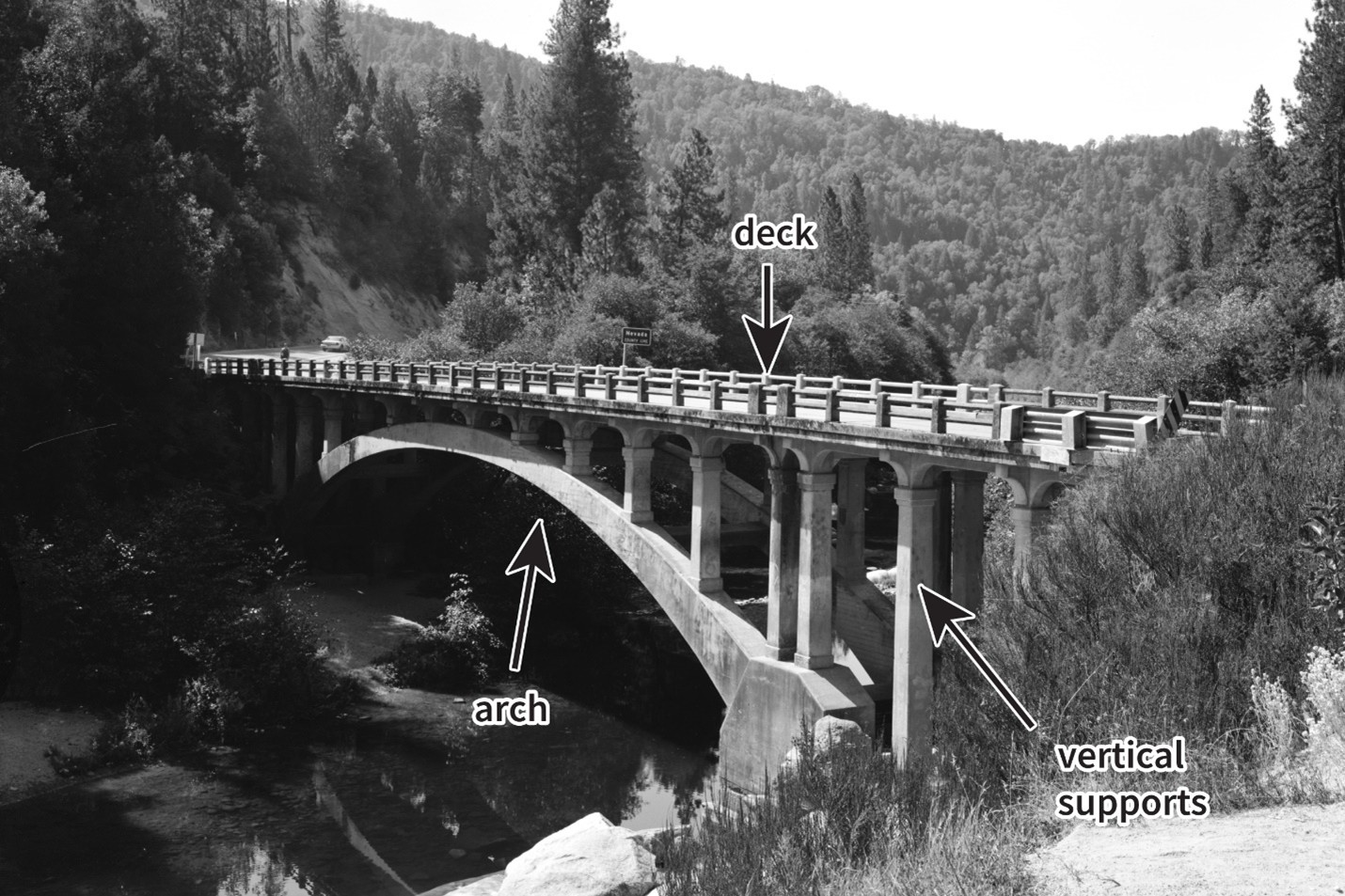
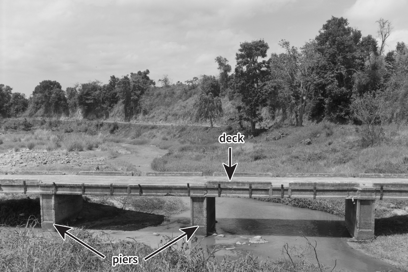
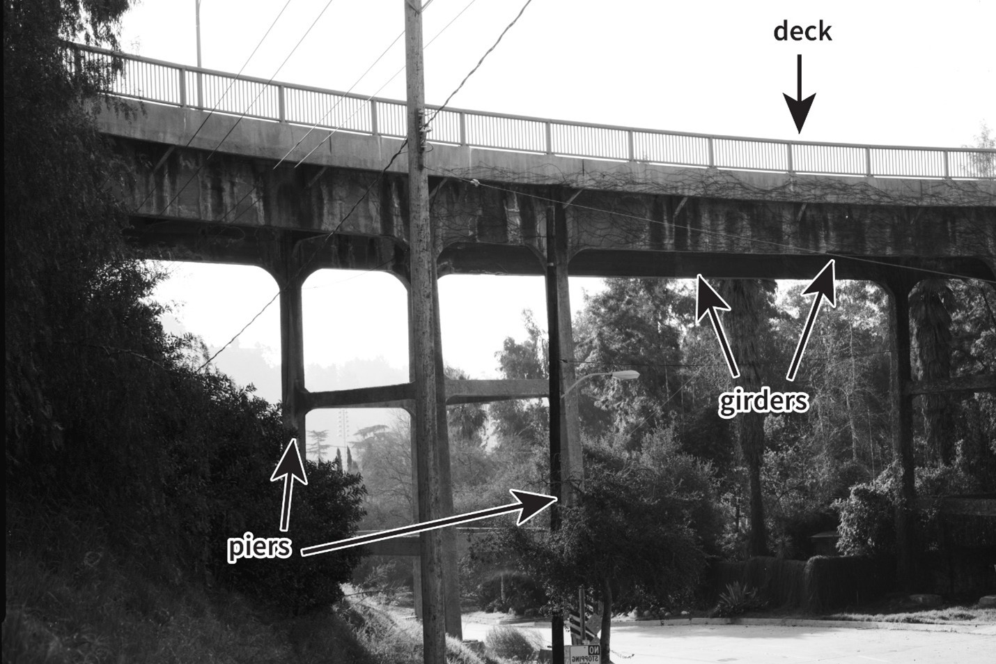
The first reinforced concrete bridge in the United States was the 1889 Lake Alvord Bridge in San Francisco. Over time, four major reinforced concrete bridge types emerged: closed spandrel, open spandrel, concrete slab, and concrete girder.
A closed spandrel bridge consists of a solid concrete arch form with vertical sidewalls to form spandrels. The space inside the arch is filled, typically with dirt, and the bridge deck is placed on top of the dirt. The Lake Alvord Bridge was a closed spandrel bridge. Examples in California were mostly constructed before World War I.
An open spandrel bridge also consists of an arch, but in place of solid walls there are vertical columns supporting the deck. The earliest example in California is the 1911 Buena Vista (now Broadway) Street Bridge in Los Angeles. Very few open spandrel bridges were built after World War II.
A concrete slab bridge consists of one slab of reinforced concrete that serves as both the structure and deck of the bridge. The slab is supported by vertical piers. Concrete slab bridges were typically limited to very short crossings; however, improvements in technology have allowed for longer spans.
A concrete girder bridge consists of horizontal members (or girders) that extend the length of the bridge and support the bridge deck from below. For long bridges, the girders may be supported by vertical piers. Concrete girder bridges became more and more common during the 1930s and 1940s and are still built today.
A pioneer of reinforced concrete bridge construction was engineer John B. Leonard. In 1914, he began developing a new type of reinforced concrete bridge design he called “canticrete.” It was a variation of the closed spandrel, consisting of cantilevered steel trusses encased in concrete.
A truss is a structural framework made up of triangular shapes for strength. They are often used to construct bridges and roofs. In simple terms, a cantilever is a projecting structural element that is only supported or anchored at one end.
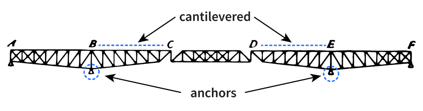
Because the trusses were strong, canticrete bridges generally required less steel and concrete to build than some earlier reinforced concrete bridge designs. The trusses also supported themselves during construction, so less temporary falsework was needed.
The design team for a new Seventh Street Bridge included consulting engineers John B. Leonard and William Peyton Day, Chief Engineer of the Stanislaus County Highway Commission Edgar H. Annear, and consulting architect Lafayette “Fay” R. Spangler.
The design for a new bridge needed to be large and sturdy enough to handle increased traffic over time. It also needed to use as little steel as possible, because the price of steel had nearly doubled at the onset of World War I. A canticrete bridge, which required less steel, was the solution.
The plans for the Seventh Street Bridge called for Beaux Arts detailing with cast stone lions while structure of the bridge was a series of steel trusses encased in concrete.
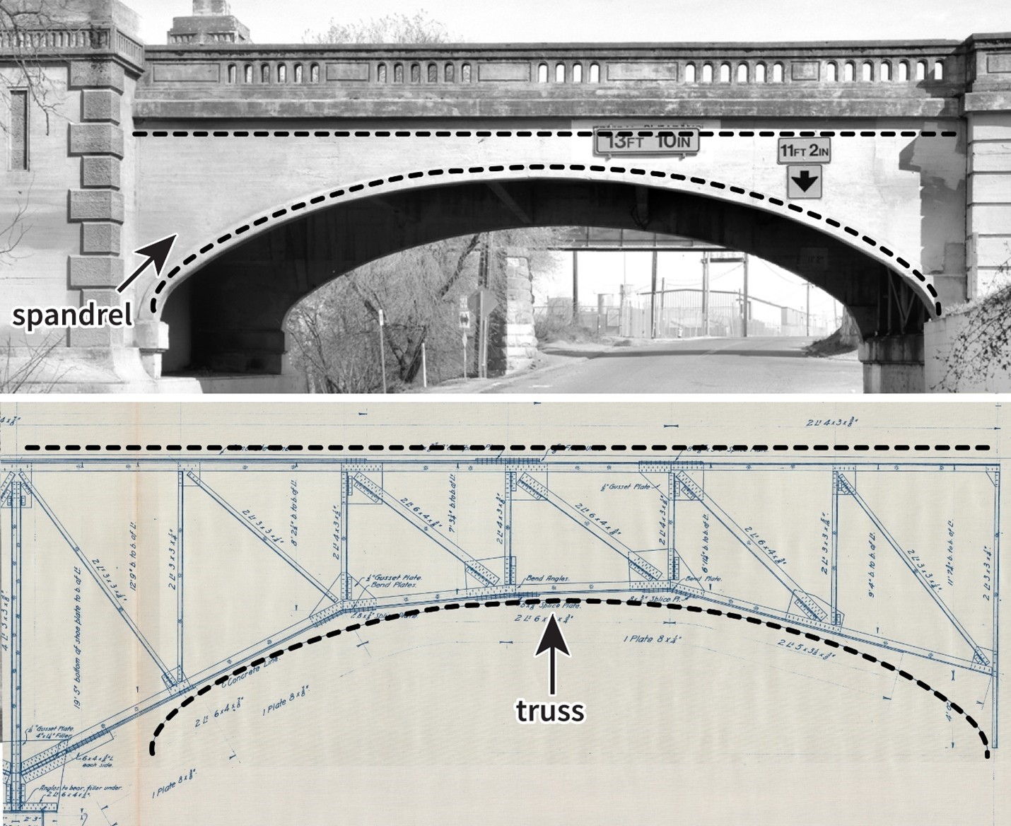
spandrels and their internal truss structure.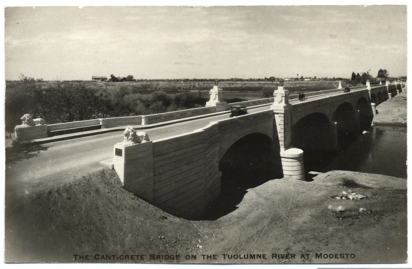
Construction of the Seventh Street Bridge was overseen by Oakland-based contractor Charles E. Cotton. At least eleven canticrete bridges like the Seventh Street bridge were constructed, but few remain. The way the trusses are assembled, they are almost like individual structures. Because of this, they can shift separately over time, causing cracks, uneven surfaces, and dangerous conditions.
The Seventh Street Bridge’s unique design caused it to deteriorate over time, creating the need for a safe, new bridge for vehicles, bicycles, and pedestrians. Special elements of the original bridge are proposed to be saved and added to a pedestrian plaza to commemorate and share its important history.
Image 1:
Tenth Street. Modesto, Cal. Postcard. Brooklyn, NY: The Albertype Company, 1917. Courtesy of the California History Room, California State Library, Sacramento, California.
Image 2:
Bridges, Tuolumne River, Modesto. Postcard. No date.
Image 3:
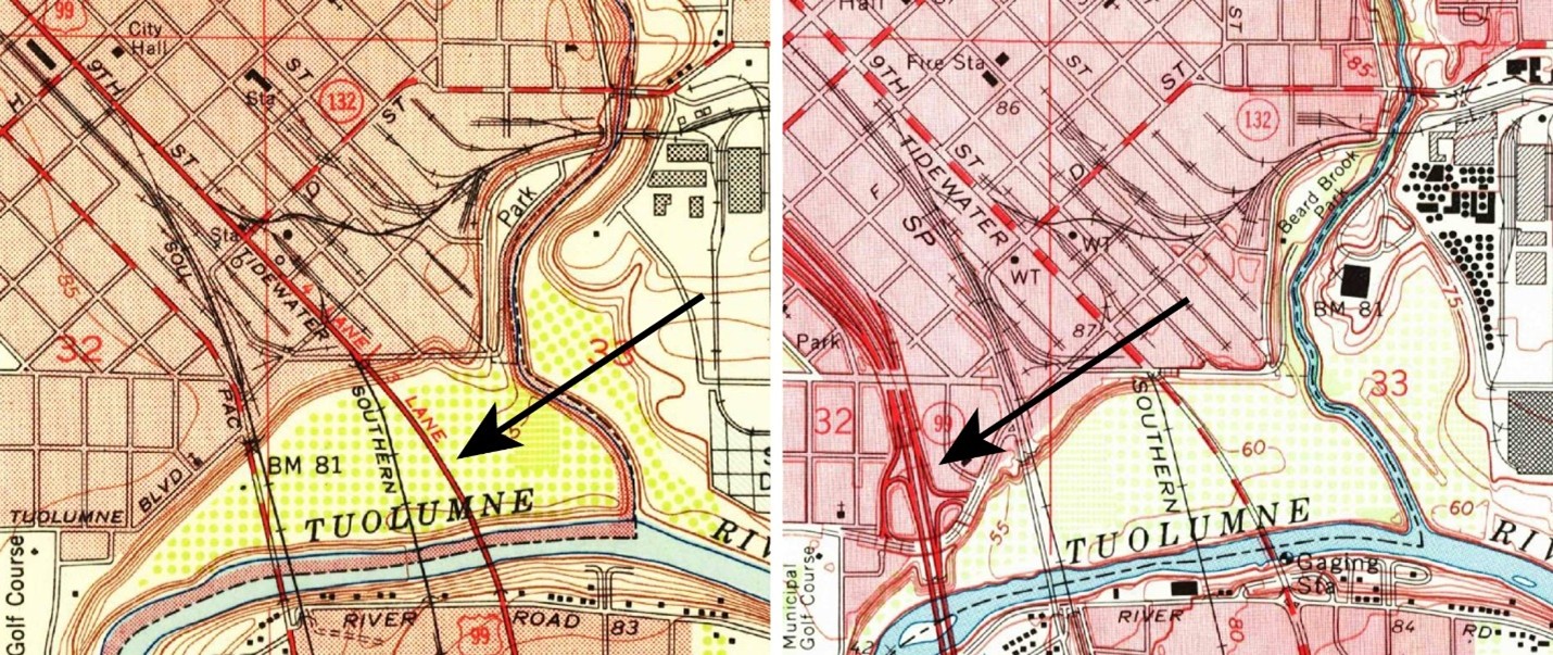
LEFT – Riverbank Quadrangle, California. 7.5 Minute Series. 1953. Courtesy of the United States Geological Survey.
RIGHT – Riverbank Quadrangle, California. 7.5 Minute Series. 1969. Courtesy of the United States Geological Survey.
Image 4:
American Lithographic Company. Hupmobile United America Tour. Map. Washington DC: National Highway Association, 1918. American Geographical Society Library Digital Map Collection, Library of Congress.
Image 5:
Base image courtesy of Google Maps.
Image 6-7:
E.H. Annear, Leonard & Day and Fay R. Spangler. Reinforced Concrete Bridge Over the Tuolumne River,
Near the City of Modesto, Stanislaus Co., Cal. April 1, 1916. Sheet 3.
Image 8:
LEFT – Boucher, Jack E. “Detail of lion sculpture, southwest abutment.” Photo, 1993. Connecticut Avenue Bridge (William H. Taft Bridge), Spanning Rock Creek and Potomac Parkway, Washington, District of Columbia. Historic American Engineering Record, National Park Service, U.S. Department of the Interior, From Prints and Photographs Division, Library of Congress.
RIGHT – Hill, Dennis. “View of lion, bench, walkway and roadway from the southern end of bridge, looking north.” Photo, 2020. Seventh Street Bridge Over the Tuolumne River, Modesto, Stanislaus County, CA. Historic American Engineering Record, National Park Service, U.S. Department of the Interior, From Prints and Photographs Division, Library of Congress.
Image 9:
Hicks, Robert A. “Elevation of Bridge from Pleasants Valley Creek Bed View to West.” Photograph, 1997. Pleasants
Valley Road Bridge, Vacaville, Solano County, CA. Historic American Engineering Record, National Park Service, US Department of the Interior, From Prints and Photographs Division, Library of Congress.
Image 10:
Tateishi, Don. “Contextual Oblique View Of Bridge in its Setting, Looking South From Upstream.” Photograph,
1992. Freeman’s Crossing Bridge, North San Juan vicinity, Nevada and Yuba County, CA. Historic American Engineering Record, National Park Service, US Department of the Interior, From Prints and Photographs Division, Library of Congress.
Image 11:
Mendez-Caratini, Hector. “Southwest Side -Partial Elevation of Southeastern Quarter of the Bridge from Hill,
Showing The Quebrada Puerco Brook.” Photograph, 2000. Puente de la Marina, San Lorenzo, Puerto Rico. Historic American Engineering Record, National Park Service, US Department of the Interior, From Prints and Photographs Division, Library of Congress.
Image 12:
Zimmerman, Tom. “View looking West, from Seco Street.” Photograph, 1984. Prospect Boulevard Bridge,
Pasadena, Los Angeles County, CA. Historic American Engineering Record, National Park Service, US Department of the Interior, From Prints and Photographs Division, Library of Congress.
Image 13:
Base image from Merriman, Mansfield and Henry S. Jacoby. A Textbook on Roofs and Bridges, Part IV: Higher Structures. New York: Wiley & Sons, 1899.
Image 14:
TOP – Hill, Dennis. “View of arch, pillar and railing passing over River Road from Zeff Road, looking northeast.” Photo, 2020. Seventh Street Bridge Over the Tuolumne River, Modesto, Stanislaus County, CA. Historic American Engineering Record, National Park Service, US Department of the Interior, From Prints and Photographs Division, Library of Congress
BOTTOM – E.H. Annear, Leonard & Day and Fay R. Spangler. Reinforced Concrete Bridge Over the Tuolumne River, Near the City of Modesto, Stanislaus Co., Cal. April 1, 1916. Sheet 11.
Image 15:
The Canticrete Bridge on the Tuolumne River at Modesto. Postcard, No date. Courtesy of the California History Room, California State Library, Sacramento, California.
Art Institute of Chicago. “Lion (One of a Pair, South Pedestal).” Accessed December 2023. https://www.artic.edu/artworks/656/lion-one-of-a-pair-south-pedestal.
The Center for Legislative Archives. “Hetch Hetchy Environmental Debates.” Accessed December 2023. https://www.archives.gov/legislative/features/hetch-hetchy.
Clarke, Jane H. “The Art Institute’s Guardian Lions.” Art Institute of Chicago Museum Studies 14, no. 1 (1988): 46-55, 102-103. https://www.jstor.org/stable/4108772.
Davis, Tim, and Amy Ross. “Connecticut Avenue Bridge.” HAER DC-6. Historic American Engineering Record (HAER), National Park Service, US Department of the Interior, 1992. Accessed December 2023, https://www.loc.gov/pictures/item/dc0594/.
Duane, Amanda and Christine Cruiess. “Seventh Street Bridge Over the Tuolumne River.” HAER No. CA-2379. Historic American Engineering Record (HAER), National Park Service, US Department of the Interior, 2020. Accessed December 2023, https://www.loc.gov/pictures/collection/hh/item/ca4490/.
GPA Consulting, “Beaux Arts Classicism, Neoclassical, and Italian Renaissance Revival Architecture, 1895-1940.” Los Angeles Citywide Historic Context Statement. City of Los Angeles Office of Historic Resources. July 2018. Accessed December 2023, https://planning.lacity.org/odocument/a5151e47-83da-41b7-ae95-dda56667848b/Beaux_Arts_Classicism_Neoclassicism_and_Italian_Rennaissance Revival_1895-1940.pdf.
“Good Roads for Stanislaus.” The Oakdale Graphic. November 3, 1916.
Lawson, Natalie. Archaeological Survey Report: 7th Street Bridge Project in the City of Modesto, Stanislaus County, California. Stockton: Caltrans District 10, March 2015.
Lee, Jason. “An Economic Analysis of the Good Roads Movement.” Diss., University of California, Davis, 2012. Accessed December 2023. https://escholarship.org/content/qt5ct198kp/qt5ct198kp.pdf.
National Park Service. “Hetch Hetchy Reservoir – O’Shaughnessy Dam.” Accessed December 2023. https://www.nps.gov/places/000/hetch-hetchy-reservoir-oshaugnessy-dam.htm.
“New Bridge Opening on Thursday.” Modesto Morning Herald. March 13, 1917.
New York Public Library. “The Library Lions.” Accessed December 2023. https://www.nypl.org/help/about-nypl/library-lions.
NOAA Fisheries. “Habitat Conservation: San Joaquin River Basin.” Accessed December 2023. https://www.fisheries.noaa.gov/west-coast/habitat-conservation/san-joaquin-river-basin.
“Progressive Era to New Era, 1900-1929.” Library of Congress. Accessed December 2023, https://www.loc.gov/classroom-materials/united-states-history-primary-source-timeline/progressive-era-to-new-era-1900-1929/.
Reid, Gerald F., and Sarah Berry. “Yokuts.” Yale University Human Relations Area Files. Accessed December 2023. https://ehrafworldcultures.yale.edu/cultures/ns29/summary.
Shore, Marty. “Symbolism Roars to Life on Capitol Hill.” Architect of the Capitol. March 6, 2018. Accessed December 2023. https://www.aoc.gov/explore-capitol-campus/blog/symbolism-roars-life-capitol-hill.
Snow, Meagan. “Maps of the Good Roads Movement.” Library of Congress. April 14, 2022. Accessed December 2023. https://blogs.loc.gov/maps/2022/04/maps-of-the-good-roads-movement/.
San Francisco Planning Department. Final Program Environmental Impact Report for the San Francisco Public Utilities Commission’s Water System Improvement Program: Volume 3 of 8. City and County of San Francisco, June 29, 2007. Accessed December 2023. https://sfplanning.s3.amazonaws.com/archives/documents/7941-2005.0159E_vol3_sec5-3_wsip_finalpeir.pdf.
“Stanislaus Plans Road Celebration.” San Francisco Chronicle. March 18, 1917.
Tachi Yokut Tribe, “Historical Documents.” Accessed December 2023. https://www.tachi-yokut-nsn.gov/.
Tuolumne River Trust. “Restore.” Accessed December 2023. https://www.tuolumne.org/restore.